Originally published by Michelle Davey on 13 May 2022.
Last week I was part of a group privileged to visit two carbon offset projects in the far outback of south-west Queensland. Flying up from Melbourne via Brisbane and Roma, we continued further west past the Surat Basin gas fields to predominantly cattle country. A seven-hour journey seeing us land in Charleville, the largest town in the Murweh Shire. We spent our first afternoon exploring the town and its historic museum. In doing so we took a turn back in time, listening to records from the 1920s and experiencing a wonderful performance by George, the museum’s custodian, on an Autoharp. The museum showcased, among other things, an old beer bottling machine, steam engine, carriage, and railway ambulance.
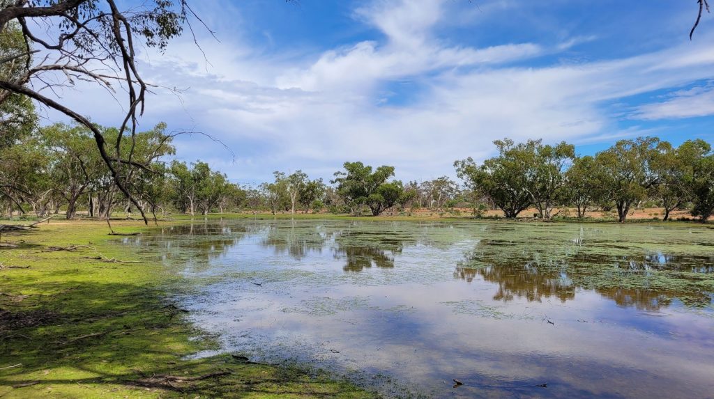
On day 2 we travelled south, into the Shire of Paroo to visit a project near Wyandra, where we start to spot areas of bushland regeneration. On this working cattle station, this regeneration is enabled through a change of management practices, the construction of exclusion fencing and ceasing of bulk land clearing once done using bulldozers and chains. This regeneration is achievable while ensuring the land remains open to livestock farming. To increase water efficiency the station facilitates underground pipes delivering precious water from boreholes and dams to water troughs strategically distanced apart to ensure continual access to water for cattle. Yet cattle are not the only species which reside on these properties. A plethora of wildlife beyond cattle inhabit the area and, much to my surprise, the station housed native wetlands which were teeming with an array of flora, cranes, and other creatures.

Historic House and Charleville Museum.

Wetlands on the station near Wyandra.

Flowers growing in the wetlands.
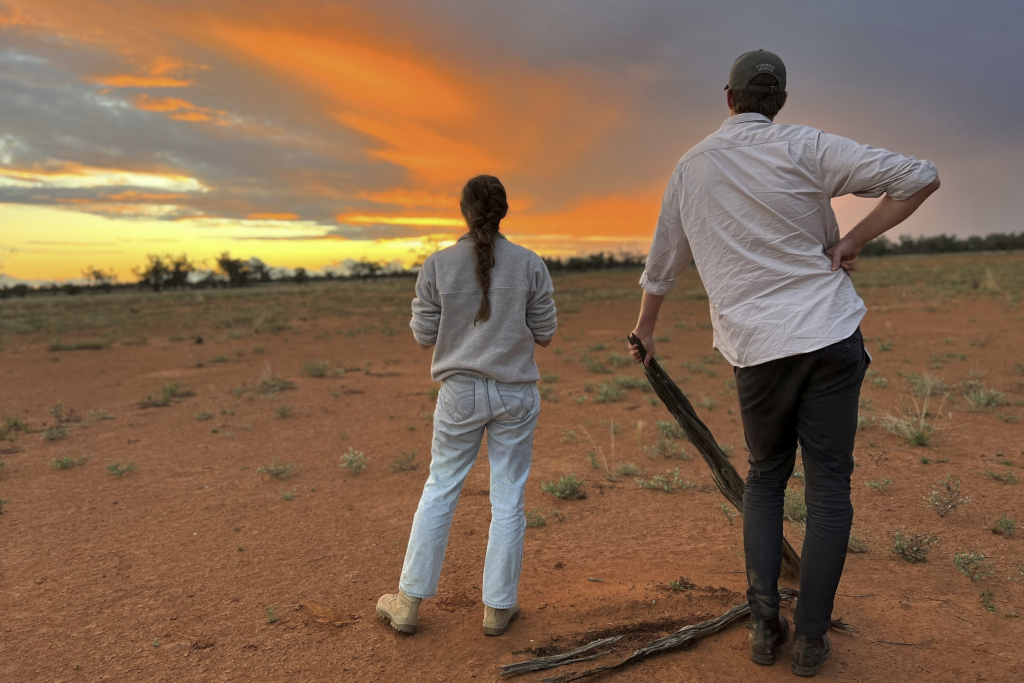
As the light began to wane, we retreated from the bush. Reaching the main road, where we were due to part ways with Esteban, the photographer who had accompanied us on the trip, phones reconnected to cell towers and inspiration of a sunset photo came through. Luckily, our arrival at golden hour was the perfect lighting for both Nick Anstey and Stuart Macleod to realise their dream of becoming hand models. We finished day two heading south to Cunnamulla, where, after a slight accommodation hiccup we enjoyed a great pub meal.
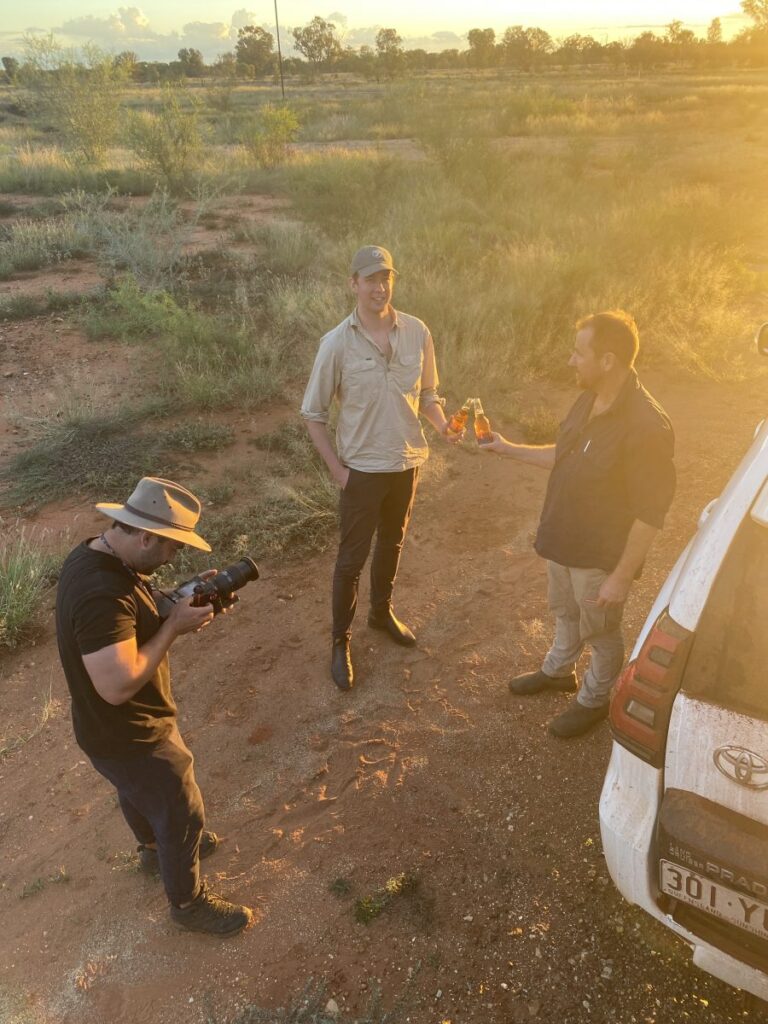
Esteban photographing hand models Nick and Stuart.
Wednesday morning broke bright and early. No longer concerned about interfering with Esteban’s airspace I figured it was time to give my own drone a workout. Starting the day exploring the town by air and breakfast in the one open café prior to heading two hours east offered a wonderful beginning.

Central roundabout on Jane Street, Cunnamulla just after sunrise.
On our way to today’s property, we experienced the devastation of widespread clearing on the land and had the opportunity to contrast this with the regeneration and new growth forests on the property.

Land which has experienced widespread clearing.
Contrasting the above, the property on which we were to spend the day provided prime examples of human-induced regeneration. This working cattle station had previously been subject to land clearing and suppression activities which resulted in loss and constraint of forest cover during the baseline period. Changes to the land management regime of the project area resulted in human-assisted regeneration activity. This includes the establishment of fencing to exclude livestock and remove or exclude feral animals and a clear intention that no more mechanical suppression of regrowth will occur on the project site.
Given the scale of properties on which Emission Reduction Fund (ERF) Projects are established – the project visited on day 2 was 85,000 acres while the property on day 3 was 25,000 acres – these properties are assessed in terms of sub-sections of the land, whereby some areas of the property may be eligible to generate carbon credits and other areas are not. The image below is a clear example of how this methodology would be applied. In the foreground are areas of land which previously experienced forest suppression. Changed land management practices and regeneration are evident within the area enabling this section of the property eligible to receive Australian Carbon Credit Units (ACCUs) after undergoing significant monitoring and verification audits. The established areas shown to the right of the photograph display canopy cover greater than 20% of the area at a height exceeding 2 metres. As such, this area is deemed to be established forest cover and would not be eligible to receive ACCUs.
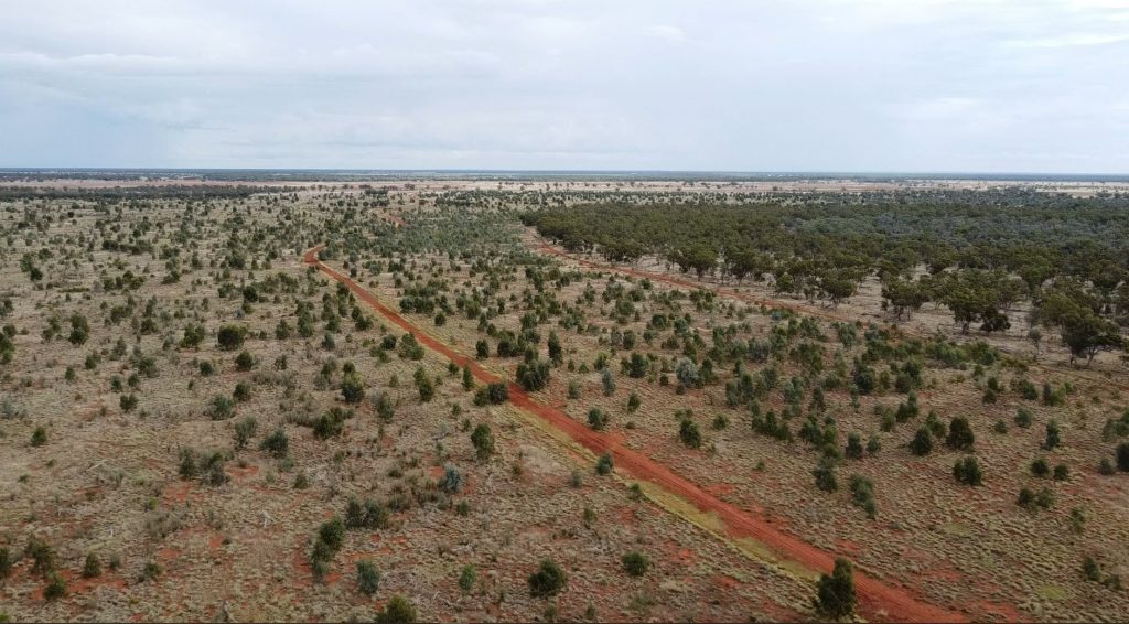
Regeneration activity in foreground of photograph and established forest cover in right background.
After investigating the property more thoroughly, including its various creeks and paddocks, we took a moment to observe several resident kangaroos having a drink from pooling rainwater. We noticed that the day had passed in what felt like the blink of an eye. The mesmerising sunset we experienced heading west, back to Cunnamulla, dictated one final stop for the day, allowing us to enjoy the sun dance across the clouds, kick an empty water bottle as if it were a football and soak in the harmony which being in outback Queensland brought into our souls.

Sunset over the paddock.
All too soon it was time to head back to Melbourne via Charleville, Roma, and Brisbane. Our week in south-west Queensland created memories which will last a lifetime and painted colour into how human-induced regeneration projects operate, result in carbon sequestration and how carbon offset projects can work in tandem with continual cattle operations. Thank you to TEM and particularly Stuart to opening my eyes to this wonderous place. I am excited to experience how these projects continue to grow and see the extraordinary impact they will have.

